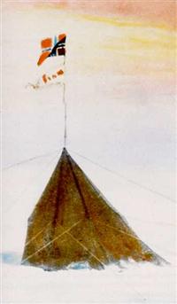
Amundsen's original South Pole Station
|
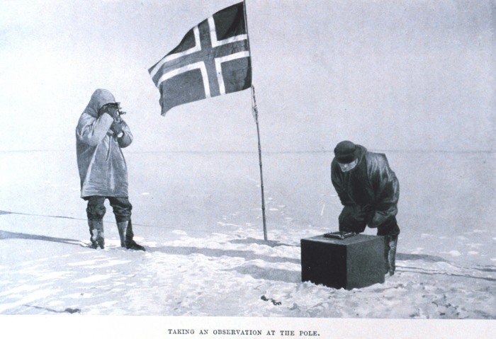
At Polheim the team took a series of hourly observations for a 24-hour period to confirm their location. What is of interest here is that Amundsen describes his "four navigators" as being Helmer Hanssen, Oscar Wisting, Sverre Hassel and himself--everyone BUT Bjaaland. Using Amundsen's diary, Roland Huntford (in The Amundsen Photographs) describes the photo as "Shooting the sun at the South Geographical Pole. Amundsen (left in the top photo) is holding a sextant. Helmer Hanssen (right) is bending over the artificial horizon, which is a tray of mercury. Amundsen is lining up the direct image of the sun with its reflection in the surface of the mercury." Neither Amundsen nor Huntford identify the precise location of the "taking an observation" photo. But Amundsen describes the observation point at Polheim as being a solid snow pedestal, while the depicted platform appears to be a crate. So the photo was perhaps taken at the initial stopping point. In any case Amundsen considered the entire area as "the Pole," while at the same time he made certain he had gotten as close as possible using the available technology. To that end, Bjaaland and Hanssen went about 4-1/2 miles north along the newly identified meridian.
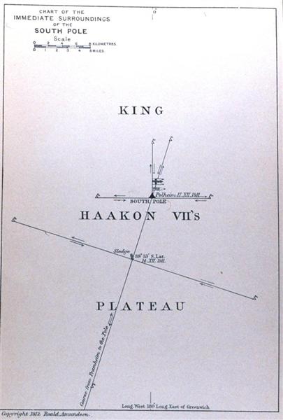
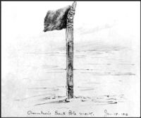
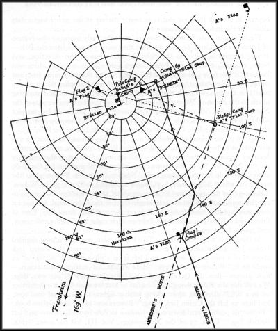
Amundsen's published map seen above is actually an idealized fantasy drawn up by Tho. Nilsen, First Officer of the Fram, after the polar party had returned to the ship. When Amundsen got back to Norway, he submitted his data and calculations to an astronomer for review; the original analysis and another diagram are included as an appendix to Amundsen's book The South Pole. Later, Amundsen's calculations (along with Scott's) were further analyzed by Arthur Hinks (who had conducted the 1909 seminar). In 1944, Hinks published his analysis in The Geographical Journal in a paper titled "The Observations of Amundsen and Scott at the South Pole" (see detailed link to that paper below). That paper included a composite diagram (at left) of the Pole positions reached by Amundsen and Scott. As you can see, the Hinks' chart looks quite a bit different from Amundsen's, and it would appear that both Amundsen and Scott got within a mile or two of the actual Pole. So who really is depicted in the above photo? No one is left alive who can resolve the question. It is known that the camera was Bjaaland's snapshot camera. Amundsen had a more elaborate camera, but it was damaged and his photographs were lost. The 1961 notes about the "Taking an Observation" photo given to South Pole Station were almost certainly those left with (or on the back of) the photo by Olav Bjaaland and used by the unknown Navy correspondent who wrote up the original article (see the first reference at the bottom of this page). In any case, the gift of the photo to the station was a magnificent gesture! Regarding Amundsen's photo and map: they are from The South Pole, 1912, by Roald Amundsen, Vol. II, p. 112 (photo) and p. 121 (map). The images used are from the NOAA photo library, where large-scale images are available (the photograph and the map). The small flag is by Dr. Edward A. Wilson. It was originally published in Scott's Last Expedition, VOL. I. BEING THE JOURNALS OF CAPTAIN R. F. SCOTT, R.N., C.V.O., arranged by Leonard Huxley, 1913. The flag sketch and the composite Pole map were found in "The Observations of Amundsen and Scott at the South Pole," by Arthur R. Hinks, in The Geographical Journal (journal of the Royal Geographical Society, London), Vol. CIII, No. 4, April 1944. The color image of the tent is discussed and credited here. The discussion of Hinks' 1909 navigation seminar was found in Scott and Amundsen, 1979, by Roland Huntford. Also consulted were The Amundsen Photographs, 1987, edited by Roland Huntford, and Antarctica, My Destiny, 1979, by Finn Ronne. By the way, Roald Amundsen's book has been available for free download, in either text or various other formats, from Project Gutenberg. Here is Amundsen's book The South Pole. Scott's diary is available as well--Scott's Last Expedition (Volume I), which covers the period up to his death. Also, the NOAA Photo Library has a historical section "Exploring and Surveying" in their "Treasures of the Library" section--this includes many more photos from Scott's and Amundsen's expeditions as well as from other polar and world explorers. A copy of the photograph at the top of this page was given to the station in 1961 by photographer Olav Bjaaland as part of the recognition of the 50th anniversary of Amundsen's and Scott's arrival at Pole; here is more information about that photograph and about the ceremony. Searches for buried old stations at Pole can be hazardous. At least one serious venture in recent years resulted in a tragic death, as documented by USA Today and the Antarctic Journal.. |
